قائمة المدن حسب عدد السكان
هذه قائمة المدن حسب عدد السكان والمرتبة بناء على عدد السكان لكل مدينة بإحيائها ضمن الحدود البلدية. وتستثنى الأقاليم والضواحي الجديدة الملحقة ببعض المدن. وتضم القائمة أيضا معلومات إحصائية مهمة مثل المساحة الإجمالية والكثافة السكانية.

تعداد السكان
| مرتبة | مدينة | صورة | عدد السكان | التعريف | مجموع area (كم²) |
عدد السكان density (/كم²) |
الدول |
|---|---|---|---|---|---|---|---|
| 1 | تشونغتشينغ | 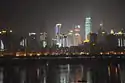 |
30٬165٬500[1] | Municipality | 82٬403[2] | 366 | |
| 2 | شانغهاي | .jpg.webp) |
24٬183٬300[3] | Municipality | 6٬340٫5[4] | 3٬814 | |
| 3 | بكين | 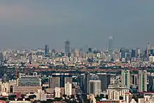 |
21٬707٬000[5] | Municipality | 16٬411[2] | 1٬267 | |
| 4 | إسطنبول |  |
15٬029٬231[6] | قائمة البلديات الكبرى في تركيا | 5٬196[7] | 2٬893 | |
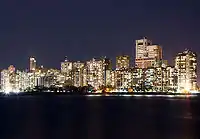
| 5 | كراتشي | 14٬910٬352[8] | مدينة[9] | 3٬780 | 3٬944 | ||
| 6 | دكا | 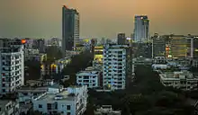 |
14٬399٬000[10] | عاصمة | 337٫54[11] | 42٬659 | |
| 7 | طوكيو | .jpg.webp) |
13٬515٬271[12] | محافظات اليابان | 626٫99[12] | 21٬556 | |
| 8 | موسكو | .jpg.webp) |
13٬200٬000[13] | مدن فدرالية في روسيا[14][15] | 2٬511[16] | 5,256 | |
| 9 | غوانزو |  |
13٬081٬000[17] | مدينة (sub-provincial) | 7٬434[17] | 1٬760 | |
| 10 | شنجن | 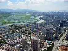 |
12٬528٬300[18] | مدينة (sub-provincial) | 1٬992[19] | 6٬889 | |
| 11 | مومباي | 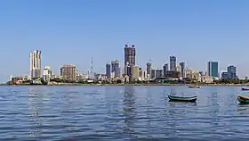 |
12٬442٬373[بحاجة لمصدر] | مدينة[20] | 437٫71[21] | 28٬426 | |
| 12 | ساو باولو | 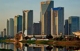 |
12٬038٬000[22] | Municipality[23] | 1٬081٫05 | 11٬199 | |
| 13 | كينشاسا | 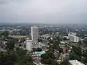 |
11٬462٬000[24][25] | City province[26] | 473٫73[27] | 24٬195 | |
| 14 | تيانجين |  |
11٬249٬000[17] | Municipality | 11٬920[28] | 944 | |
| 15 | لاهور |  |
11٬126٬000[8] | مدينة كبرى | 502٫55[24] | 22٬139 | |
| 16 | دلهي |  |
11٬034٬555[بحاجة لمصدر] | عاصمة | 461٫83 | 23٬893 | |
| 17 | جاكرتا | 10٬624٬000[29] | Special capital region[30] | 661٫50 | 16٬060 | ||
| 18 | دونغ غوان |  |
10٬615٬000[31] | مدينة | 2٬460 | 4٬315 | |
| 19 | سول |  |
9٬806٬000[32] | Special city | 605٫25[33] | 16٬202 | |
| 20 | فوشان | 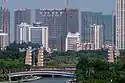 |
9٬279٬000[34][35] | مدينة | 3٬797[36] | 2٬444 | |
| 21 | تشنغدو |  |
9٬012٬000[17] | مدينة (sub-provincial) | 14٬312[17] | 630 | |
| 22 | ليما | 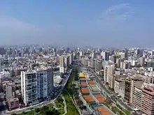 |
8٬894٬000[37] | عاصمة[38] | 2٬672 | 3٬329 | |
| 23 | مدينة مكسيكو | 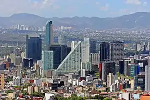 |
8٬918٬653[39] | عاصمة | 607٫22[40] | 14٬616 | |
| 24 | لندن |  |
8٬825٬001[41] | عاصمة[42] | 1٬572 | 5٬614 | |
| 25 | طهران |  |
8٬694٬000[43] | عاصمة[44] | 574٫13[45] | 15٬143 | |
| 26 | بنغالور | 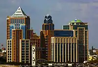 |
8٬443٬675[بحاجة لمصدر] | مدينة | 709 | 11٬909 | |
| 27 | نيويورك |  |
8٬398٬748[46] | مدينة[47] | 786٫30 | 10٬681 | |
| 28 | بغداد | 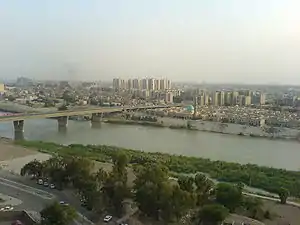 |
8,126,182[48] | حاضرة[49] | 424٫53[50] | 16٬001 | |
| 29 | شنيانغ | 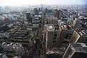 |
8٬106٬171[51] | مدينة (sub-provincial) | 12٬980 | 625 | |
| 30 | ووهان |  |
8٬035٬000[52] | مدينة (sub-provincial)[53] | 8٬494[54] | 946 | |
| 31 | بوغوتا |  |
7٬963٬000[55] | Capital District[56] | 428٫26[57][58] | 18٬594 | |
| 32 | نينغبو |  |
7٬605٬689[59] | مدينة (sub-provincial) | 9٬816٫23 | 775 | |
| 33 | القاهرة | 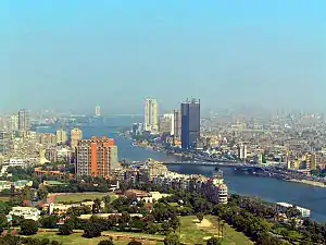 |
7٬601٬018[60] | مدينة[61] | 302٫56[62] | 25٬582 | |
| 34 | مدينة هو تشي منه |  |
7٬431٬000[63] | مدينة | 453٫60[63] | 16٬382 | |
| 35 | هونغ كونغ | 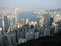 |
7٬298٬600[64] | مقاطعات هونغ كونغ[65] | 1٬104٫43[66] | 6٬608 | |
| 36 | نانجينغ |  |
7٬260٬000[67] | مدينة (sub-provincial) | 6٬582 | 1٬103 | |
| 37 | هانوي |  |
7٬232٬700[63] | هانوي | 3٬324٫5[63] | 2٬176 | |
| 38 | تشانغشا |  |
7٬044٬118[68] | مدينة[69] | 11٬819 | 596 | |
| 39 | هانغتشو |  |
7٬035٬000[70] | مدينة (sub-provincial) | 850٫83[70] | 8٬268 | |
| 40 | حيدر آباد |  |
6٬993٬262[71] | مدينة | 651٫75[72] | 11٬494 | |
| 41 | تشيناي |  |
6٬727٬000[73] | Municipal corporation[74] | 426٫51[75] | 15٬772 | |
| 42 | الرياض |  |
6٬694٬000[76] | مدينة[77] | 410٫97[78] | 16٬288 | |
| 43 | ريو دي جانيرو | 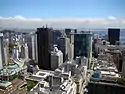 |
6٬520٬000[79] | بلديات البرازيل | 751٫44[80] | 8٬677 | |
| 44 | شيان | 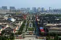 |
6٬220٬000[81] | مدينة (sub-provincial)[82] | 10٬135 | 614 | |
| 45 | سوجو |  |
5٬983٬000[83] | مدينة[84] | 8٬488[85] | 705 | |
| 46 | بانكوك | 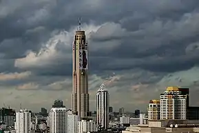 |
5٬782٬000[86] | Special administrative area[87] | 764٫73 | 7٬561 | |
| 47 | سنغافورة |  |
5٬607٬000[88] | مدينة | 602٫75[88] | 9٬302 | |
| 48 | أحمد آباد | 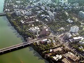 |
5٬570٬585[89] | مدينة | 351٫21 | 15٬861 | |
| 49 | سانتياغو | 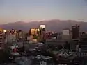 |
5٬561٬000[90] | مدينة[91] | 595٫49 | 9٬339 | |
| 50 | شانتو |  |
5٬391٬028[92] | مدينة | 2٬064٫42 | 2٬611 | |
| 51 | سانت بطرسبرغ | 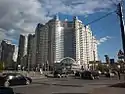 |
5٬351٬000[93] | مدينة | 1٬439[94] | 3٬719 | |
| 52 | هاربن |  |
5٬299٬000[95][96] | مدينة (sub-provincial) | 614٫31[97] | 8٬626 | |
| 53 | دار السلام | .jpg.webp) |
5٬257٬000[98] | مدينة[99] | 330٫52[100] | 15٬905 | |
| 54 | يانغون | .jpg.webp) |
5٬214٬000[24] | Metropolitan municipality-province[101] | 598٫75[102] | 8٬708 | |
| 55 | جوهانسبرغ | 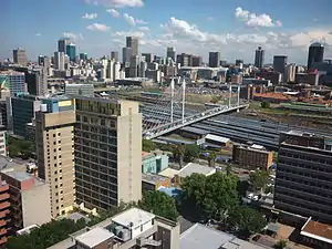 |
4٬949٬000[103] | Metropolitan municipality | 432٫84 | 11٬434 | |
| 56 | أبيدجان | 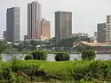 |
4٬765٬000[24] | أبيدجان | 2٬119[104] | 2٬249 | |
| 57 | الإسكندرية |  |
4٬616٬625[105] | محافظة الإسكندرية | 2٬300[106][107] | 2٬007 | |
| 58 | كلكتا |  |
4٬496٬694[108] | Municipal corporation | 185 | 24٬306 | |
| 59 | أنقرة | 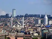 |
4٬470٬800[109] | أنقرة[110] | 1٬910٫92[111][112] | 2٬340 | |
| 60 | سورت | 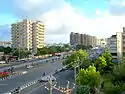 |
4٬467٬797[بحاجة لمصدر] | Municipal Corporation | 336 | 13٬297 | |
| 61 | الجيزة | 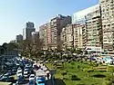 |
4٬239٬988[113] | الجيزة[114] | 289٫08 | 14٬667 | |
| 62 | تشنغتشو |  |
4٬122٬087[115] | تشنغتشو (sub-provincial)[116] | 1٬015٫66 | 4٬059 | |
| 63 | لوس أنجلوس |  |
3٬976٬322[117] | بلدية city[118] | 1٬213٫85 | 3٬276 | |
| 64 | تايبيه الجديدة | 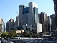 |
3٬954٬929[119] | Special municipality | 2٬052٫57[120] | 1٬927 | |
| 65 | كيب تاون |  |
3٬740٬026[103] | Metropolitan municipality | 2٬444٫97 | 1٬530 | |
| 66 | يوكوهاما |  |
3٬726٬167[12] | مدن مختارة من قبل الحكومة | 437٫49 | 8٬517 | |
| 67 | برلين | .jpg.webp) |
3٬671٬000[121] | أحياء ومناطق برلين | 891٫75 | 4٬117 | |
| 68 | بوسان |  |
3٬590٬000[122] | مدن كوريا الجنوبية الخاصة | 347٫49[122] | 10٬331 | |
| 69 | شيامن | 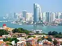 |
3٬531٬347[123] | مدينة (sub-provincial) | 1٬699 | 2٬078 | |
| 70 | جدة | 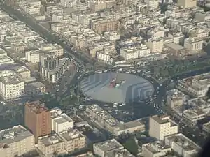 |
3٬456٬259[124] | City | 1٬765[125] | 1٬958 | |
| 71 | ديربان | 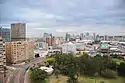 |
3٬442٬361[103] | Metropolitan municipality | 2٬291٫31 | 1٬502 | |
| 72 | كابل | 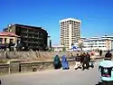 |
3٬414٬100[126] | كابل | 275 | 12٬415 | |
| 73 | الدار البيضاء | 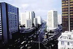 |
3٬359٬818[127] | الدار البيضاء | 230 | 14٬608 | |
| 74 | خفي | 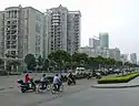 |
3٬352٬076[128] | مدينة[129] | 838٫52 | 3٬998 | |
| 75 | بيونغيانغ | 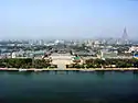 |
3٬255٬388[130] | بيونغيانغ | 2٬113[131] | 1٬541 | |
| 76 | مدريد |  |
3٬207٬247[132] | Municipality city | 605٫77 | 5٬294 | |
| 77 | فيصل آباد |  |
3٬203٬846[8] | ضواحي المدينة | 214 | 14٬971 | |
| 78 | Ekurhuleni | 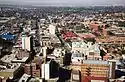 |
3٬178٬470[103] | Metropolitan municipality | 1٬975٫31 | 1٬609 | |
| 79 | نيروبي |  |
3٬138٬369[133] | محافظات كينيا | 694٫9 | 4٬829 | |
| 80 | زونغشان | 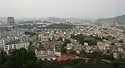 |
3٬121٬275[134] | مدينة | 1٬783٫67 | 1٬750 | |
| 81 | بونه | 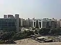 |
3٬115٬431[89] | Municipal corporation | 450٫69 | 6٬913 | |
| 82 | أديس أبابا | 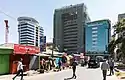 |
3٬103٬673[135] | Metropolitan municipality-province[136] | 526٫99 | 5٬889 | |
| 83 | جايبور |  |
3٬073٬350[89] | Municipal corporation | 485 | 6٬337 | |
| 84 | بوينس آيرس |  |
3٬054٬300[137] | بوينس آيرس | 203 | 15٬046 | |
| 85 | ونجو | 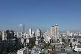 |
3٬039٬439[138] | مدينة[139] | 1٬187٫88 | 2٬559 | |
| 86 | إنتشون | 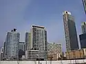 |
3٬002٬645[140] | مدن كوريا الجنوبية الخاصة | 328٫55 | 9٬139 | |
المراجع
- "2015年重庆常住人口3016.55万人 继续保持增长态势-今日重庆-华龙网" 2015年重庆常住人口3016.55万人 继续保持增长态势 [2016年重庆常住人口3670万人 继续保持增长态势] (باللغة الصينية). Chongqing News. 28 يناير 2016. مؤرشف من الأصل في 29 يناير 2016. اطلع عليه بتاريخ 13 فبراير 2016. الوسيط
|CitationClass=تم تجاهله (مساعدة) - "Doing Business in China – Survey". Ministry of Commerce – People's Republic of China. مؤرشف من الأصل في 05 أغسطس 2013. اطلع عليه بتاريخ 05 أغسطس 2013. الوسيط
|CitationClass=تم تجاهله (مساعدة) - "2017年上海市国民经济运行情况 (Shanghai's National Economy in 2017)". مؤرشف من الأصل في 6 يونيو 2019. الوسيط
|CitationClass=تم تجاهله (مساعدة) - "Land Area". Basic Facts. Shanghai Municipal People's Government. مؤرشف من الأصل في 23 يناير 2019. اطلع عليه بتاريخ 19 يوليو 2011. الوسيط
|CitationClass=تم تجاهله (مساعدة) - "Beijing Municipal Bureau of Statistics and NBS Survey Office in Beijing" (باللغة الإنجليزية). Beijing Bureau of Statistics. 25 يناير 2018. مؤرشف من الأصل في 20 مارس 2018. اطلع عليه بتاريخ 03 يونيو 2018. الوسيط
|CitationClass=تم تجاهله (مساعدة) - "The Results of Address Based Population Registration System, 2017". No ID. 1 February 2018. مؤرشف من الأصل في 2 مايو 2019. اطلع عليه بتاريخ 01 فبراير 2018. الوسيط
|CitationClass=تم تجاهله (مساعدة) - City Population - Population Statistics in Maps and Charts for Cities, Agglomerations and Administrative Divisions of all Countries of the World نسخة محفوظة 7 أغسطس 2019 على موقع واي باك مشين.
- Pakistan Bureau of Statistics. "Population of Major Cities - Census 2017" (PDF). مؤرشف من الأصل (PDF) في 29 أغسطس 2017. الوسيط
|CitationClass=تم تجاهله (مساعدة) - "Town/District Maps". Urban Habitat. مؤرشف من الأصل في 6 فبراير 2019. الوسيط
|CitationClass=تم تجاهله (مساعدة) - "Dhaka (Bangladesh): City Districts and Subdistricts". مؤرشف من الأصل في 3 فبراير 2019. الوسيط
|CitationClass=تم تجاهله (مساعدة) - Brinkhoff, Thomas. "Bangladesh: Districts and Cities". CityPopulation. مؤرشف من الأصل في 2 مايو 2019. اطلع عليه بتاريخ 20 أكتوبر 2015. الوسيط
|CitationClass=تم تجاهله (مساعدة) - Japan: Prefectures and Major Cities - Population Statistics, Maps, Charts, Weather and Web Information نسخة محفوظة 21 يناير 2019 على موقع واي باك مشين.
- "RUSSIA: Moscow". مؤرشف من الأصل في 5 يونيو 2019. الوسيط
|CitationClass=تم تجاهله (مساعدة) - "Территориальное устройство". Moscow City Government. مؤرشف من الأصل في 08 يناير 2013. الوسيط
|CitationClass=تم تجاهله (مساعدة) - The federal city of Moscow is divided into twelve administrative okrugs, which are in turn subdivided into districts (raions).
- "Ministry of Economic Development of the Russian Federation. Federal Registration, Cadastre&Cartography Service. Russia Landuse National Report 2008, p.187-188 (in Russian)" (PDF). مؤرشف من الأصل (PDF) في 10 أكتوبر 2014. اطلع عليه بتاريخ 05 أكتوبر 2014. الوسيط
|CitationClass=تم تجاهله (مساعدة) - China: Provinces and Major Cities - Population Statistics, Maps, Charts, Weather and Web Information نسخة محفوظة 11 فبراير 2019 على موقع واي باك مشين.
- "2017年深圳经济有质量稳定发展" 2017年深圳经济有质量稳定发展 [In 2017, Shenzhen economy will have stable quality and development] (باللغة الصينية). مؤرشف من الأصل في 23 فبراير 2018. اطلع عليه بتاريخ 23 فبراير 2018. الوسيط
|CitationClass=تم تجاهله (مساعدة) - "Shenzhen General Info". Shenzhen Government Online. مؤرشف من الأصل في 25 مايو 2017. اطلع عليه بتاريخ 3 يوليو 2018. الوسيط
|CitationClass=تم تجاهله (مساعدة) - Mumbai City consists of two distinct regions: Mumbai City district (Island City) and Mumbai Suburban district (Western Suburban and Eastern Suburban), grouped into 24 wards, under the administration of Brihanmumbai Municipal Corporation (BMC). The remaining area belongs to Defence, Mumbai Port Trust, Atomic Energy Commission and Borivali National Park, which are out of the jurisdiction of the BMC.
- "City Profile of Greater Mumbai" (PDF). Municipal Corporation of Greater Mumbai. مؤرشف من الأصل (PDF) في 25 أبريل 2018. اطلع عليه بتاريخ 24 أبريل 2018. الوسيط
|CitationClass=تم تجاهله (مساعدة) - "IBGE divulga as estimativas populacionais dos municípios em 2016" (باللغة البرتغالية). IBGE. مؤرشف من الأصل في 10 أغسطس 2017. اطلع عليه بتاريخ 13 ديسمبر 2016. الوسيط
|CitationClass=تم تجاهله (مساعدة) - Administratively, the Municipality of São Paulo is divided into 31 subprefectures, each in turn divided into 96 districts. Locally, districts may contain one or more neighborhoods (bairros). The city of São Paulo recognizes ten geographical areas used to reference locations in the city.
- "Demographia World Urban Areas (2014)" (PDF). Demographia. مؤرشف من الأصل (PDF) في 14 أغسطس 2019. اطلع عليه بتاريخ 17 مارس 2014. الوسيط
|CitationClass=تم تجاهله (مساعدة) - "Evenements: "Avec une population de 9,5 millions, Kinshasa est la troisième plus grande ville sur le continent africain, de taille égale à Johannesburg. Le Kinois (habitants de Kinshasa) sont connus pour leur sens de l'humour, leur musique et leur amour pour la danse."(2013)". Ville de Kinshasa. مؤرشف من الأصل في 27 أكتوبر 2001. اطلع عليه بتاريخ 27 أكتوبر 2001. الوسيط
|CitationClass=تم تجاهله (مساعدة) - The province of Kinshasa is divided into twenty-four districts, administered by the Metropolitan Municipality of Kinshasa. But the districts (communes) of Maluku and Nsele (N'Sele) are rural and not part of the city proper. The city proper (urban area) of Kinshasa is generally considered to be formed by twenty-two "communes".
- According to the Constitution of Democratic Republic of the Congo, the province of Kinshasa covers 9965.21 km2. Maluku and N'Sele (total area 8847.59 km2) are entirely rural, with a very very low density.
- "CHINA: Administrative Division of Tianjin (天津市)". مؤرشف من الأصل في 3 مارس 2016. الوسيط
|CitationClass=تم تجاهله (مساعدة) - "Statistik Daerah Provinsi DKI Jakarta 2017". BPS Provinsi DKI Jakarta. الجهاز المركزي للإحصاء الإندونيسي. مؤرشف من الأصل في 2 مايو 2019. اطلع عليه بتاريخ 23 يناير 2018. الوسيط
|CitationClass=تم تجاهله (مساعدة) - "INDONESIA: Administrative Division". مؤرشف من الأصل في 17 أغسطس 2019. اطلع عليه بتاريخ 05 أكتوبر 2014. الوسيط
|CitationClass=تم تجاهله (مساعدة) - "China – Guangdong Province (2010)". GeoHive. مؤرشف من الأصل في 14 مارس 2014. اطلع عليه بتاريخ 14 مارس 2014. الوسيط
|CitationClass=تم تجاهله (مساعدة) - 2016년 5월 행정자치부 주민등록 인구통계 نسخة محفوظة 3 March 2011 على موقع واي باك مشين.
- "Seoul Statistics (Land Area)". Seoul Metropolitan Government. مؤرشف من الأصل في 2 مايو 2019. الوسيط
|CitationClass=تم تجاهله (مساعدة) - "佛山2010年第六次全国人口普查主要数据公报[1]". City of Foshan. مؤرشف من الأصل في 9 أغسطس 2016. اطلع عليه بتاريخ 30 يناير 2014. الوسيط
|CitationClass=تم تجاهله (مساعدة) - Districts of Changcheng, Nanhai, Shunde; see فوشان
- "About Foshan". City of Foshan. مؤرشف من الأصل في 8 أغسطس 2019. اطلع عليه بتاريخ 11 مارس 2014. الوسيط
|CitationClass=تم تجاهله (مساعدة) - "PERU: Lima population". La Republica. مؤرشف من الأصل في 15 سبتمبر 2017. الوسيط
|CitationClass=تم تجاهله (مساعدة) - The province of Lima is divided into forty three "districts of Lima" which are administered by the Metropolitan Municipality of Lima.
- "MEXICO: Mexico City (2014)". CityPopulation.De. مؤرشف من الأصل في 7 يوليو 2019. اطلع عليه بتاريخ 15 مارس 2014. الوسيط
|CitationClass=تم تجاهله (مساعدة) - Consejo Nacional de Población, México; Delimitación de las zonas metropolitanas de México 2005 نسخة محفوظة 2 December 2010 على موقع واي باك مشين. Retrieved on 26 November 2010. [وصلة مكسورة]
- "Population Estimates for UK, England and Wales, Scotland and Northern Ireland". Office for National Statistics. 28 June 2018. مؤرشف من الأصل في 10 أغسطس 2019. اطلع عليه بتاريخ 16 أغسطس 2018. الوسيط
|CitationClass=تم تجاهله (مساعدة) - The 33 local authorities are the 32 London borough councils and the City of London Corporation.
- "IRAN: Tehran City (Census 2016-09-24)". CITY POPULATION.DE. مؤرشف من الأصل في 21 يناير 2019. اطلع عليه بتاريخ 25 فبراير 2014. الوسيط
|CitationClass=تم تجاهله (مساعدة) - "TEHRAN: Administrative Districts". مؤرشف من الأصل في 8 سبتمبر 2018. اطلع عليه بتاريخ 05 أكتوبر 2014. الوسيط
|CitationClass=تم تجاهله (مساعدة) - "About Teheran". Tehran Municipality. مؤرشف من الأصل في 29 أكتوبر 2018. اطلع عليه بتاريخ 25 فبراير 2014. الوسيط
|CitationClass=تم تجاهله (مساعدة) - Roberts, Sam (18 April 2019). "Is New York City's 'Remarkable Growth Story' Ending?". The New York Times. مؤرشف من الأصل في 1 مايو 2019. اطلع عليه بتاريخ 15 مايو 2019. الوسيط
|CitationClass=تم تجاهله (مساعدة) - New York City is composed of five boroughs: Manhattan, the Bronx, Brooklyn, Queens, and Staten Island.
- "سكان بغداد يتجاوزون الـ8 ملايين نسمة". RT Arabic. مؤرشف من الأصل في 04 أغسطس 2019. اطلع عليه بتاريخ 26 مايو 2020. الوسيط
|CitationClass=تم تجاهله (مساعدة) - The province of Baghdad is divided into nine district, administered by the Metropolitan Municipality of Baghdad. The districts are distributed into 89 Neighborhood Councils.
- There are many disputes about Baghdad city (urban) area. The city of Baghdad has the special status of provincial. The demographic information reported to the city proper are non-existent or are the estimates, projections inconclusive. The Metropolitan Municipality of Baghdad is a city "federal district – province". Is similar to the case of Cairo Governorate.
- "2010年沈阳市第六次全国人口普查主要数据公报(Sixth National Population Census of the People's Republic of China". No ID. مؤرشف من الأصل في 18 ديسمبر 2018. الوسيط
|CitationClass=تم تجاهله (مساعدة) - "武汉市2010年第六次全国人口普查主要数据公报--湖北省统计局 (Main Data from Wuhan 2010 Census)". Hubei Provincial Statistics Bureau. 9 August 2011. مؤرشف من الأصل في 08 مايو 2014. اطلع عليه بتاريخ 26 أغسطس 2016. الوسيط
|CitationClass=تم تجاهله (مساعدة) - The sub-provincial city of Wuhan has direct jurisdiction over 13 districts (eight urban/five rural). The city proper (urban) based on the districts of Jiang'an, Jianghan, Qiaokou, Hanyang, Wuchang and Qingshan considered "core districts" + Inner suburbs (districts): Hongshan, Dongxihu.
- Wuhan Statistical Yearbook 2010 نسخة محفوظة 5 November 2011 على موقع واي باك مشين. p. 15
- "Estimaciones y proyecciones de hogares y viviendas". DANE (2014). مؤرشف من الأصل في 02 فبراير 2016. الوسيط
|CitationClass=تم تجاهله (مساعدة) - The Capital District of Bogotá is divided into twenty districts, administered by the Metropolitan Municipality of Bogotá.
- "Límites". Bogota Government Corporation. مؤرشف من الأصل في 29 يونيو 2019. الوسيط
|CitationClass=تم تجاهله (مساعدة) - The district of Sumapaz is completely rural (no city services) and is not part of the city proper. The area was an important pilgrimage arheoligic site for the Muisca indigenous peoples in pre-Columbian times and for visiting the Sumapaz National Park. The district of Sumapaz represents 0.1% of the population (48% "area") of Bogotá Municipality.
- "Ningbo 2011 population report issued". Ningbo Municipal People's Government. مؤرشف من الأصل في 8 ديسمبر 2015. الوسيط
|CitationClass=تم تجاهله (مساعدة) - "Egypt". citypopulation.de. مؤرشف من الأصل في 5 فبراير 2019. اطلع عليه بتاريخ 20 أكتوبر 2015. الوسيط
|CitationClass=تم تجاهله (مساعدة) - In April 2011, Prime Minister Essam Sharaf abolished the Helwan Governorate and reincorporated its territory into the Cairo Governorate. The total area of the governorate is 3085.1 square kilometers, the city area is 453 square kilometers, but the Egyptian government considered the Cairo Governorate is that a whole city and all statistics relate to the "governorate".
- "EGYPT: Cairo". مؤرشف من الأصل في 3 مارس 2016. اطلع عليه بتاريخ 05 أكتوبر 2014. الوسيط
|CitationClass=تم تجاهله (مساعدة) - Statistical Handbook of Vietnam 2014 نسخة محفوظة 6 July 2015 على موقع واي باك مشين., General Statistics Office Of Vietnam
- "Hong Kong Statistics". Census and Statistics Department. The Government of the Hong Kong Special Administrative Region. مؤرشف من الأصل في 2 مايو 2019. اطلع عليه بتاريخ 04 ديسمبر 2015. الوسيط
|CitationClass=تم تجاهله (مساعدة) - The only legally defined city in Hong Kong is the مدينة فكتوريا but it serves almost no administrative function.
- "Hong Kong Geographic" (PDF). The Government of the Hong Kong Special Administration Region. مؤرشف من الأصل (PDF) في 12 مارس 2019. اطلع عليه بتاريخ 10 مارس 2014. الوسيط
|CitationClass=تم تجاهله (مساعدة) - "Census (2014)". Nanjing Municipal Bureru Statistucs. مؤرشف من الأصل في 3 فبراير 2015. اطلع عليه بتاريخ 19 يناير 2015. الوسيط
|CitationClass=تم تجاهله (مساعدة) - Hunan Statistical Bureau (2011-5-13): Hunan Major data communique of National Census 2010 نسخة محفوظة 4 March 2016 على موقع واي باك مشين.
- Based on the following districts: Furong, Tianxin, Yuelu, Kaifu, Yuhua; see تشانغشا
- "详细内容" 杭州市 2010年国民经济和社会发展统计公报 (باللغة الصينية). Hangzhou Municipal Statistic Bureau. 24 فبراير 2011. مؤرشف من الأصل في 3 سبتمبر 2011. اطلع عليه بتاريخ 15 سبتمبر 2011. الوسيط
|CitationClass=تم تجاهله (مساعدة) - "Hyderabad (Andhra Pradesh, India) - Population Statistics and Location in Maps and Charts - City Population". Citypopulation.de. مؤرشف من الأصل في 30 ديسمبر 2018. اطلع عليه بتاريخ 19 يوليو 2016. الوسيط
|CitationClass=تم تجاهله (مساعدة) - "Greater Hyderabad Municipal corporation 2010". GHMC. مؤرشف من الأصل في 1 يناير 2016. اطلع عليه بتاريخ 4 ديسمبر 2010. الوسيط
|CitationClass=تم تجاهله (مساعدة) - "Chennai: India Smart Cities Challenge". Official website of Smart Cities Challenge, India. اطلع عليه بتاريخ 19 يوليو 2016. الوسيط
|CitationClass=تم تجاهله (مساعدة)[وصلة مكسورة] - Chennai city is governed by the Chennai Corporation, dividing into three regions – fifteen districts: North (Tiruvottiyur, Manali, Madhavaram, Tondiarpet and Royapuram), South (Valasaravakkam, Alandur, Adyar, Perungudi and Sholinganallur) and Central (Thiru-Vi-Ka Nagar, Ambattur, Anna Nagar, Teynampet and Kodambakkam), which covers 200 wards. Of the total land area, reserved forests cover 2.71 km2 and is concentrated in and around the Guindy National Park region, one of the few national parks in the world located within a city.
- "Expanded Chennai Corporationto be divided into 3 regions". The Hindu. مؤرشف من الأصل في 2 يناير 2016. اطلع عليه بتاريخ 22 مارس 2014. الوسيط
|CitationClass=تم تجاهله (مساعدة) - "Composition of Population (2012)" (PDF). Arriyadh Development Authority. مؤرشف من الأصل (PDF) في 23 أغسطس 2013. اطلع عليه بتاريخ 4 مارس 2014. الوسيط
|CitationClass=تم تجاهله (مساعدة) - Riyadh is divided into 15 branch municipalities, in addition to the Diplomatic Quarter. Each branch municipality in turn contains several districts, amounting to over 130 in total, though some districts are divided between more than one branch municipality. The branch municipalities are Al-Shemaysi, Irqah, Al-Ma'athar, Al-Olayya, Al-Aziziyya, Al-Malaz, Al-Selayy, Nemar, Al-Neseem, Al-Shifa, Al-'Urayja, Al-Bat'ha, Al-Ha'ir, Al-Rawdha, and Al-Shimal ("the North").
- Arriyadh Development Authority (Investment_Arriyadh_2013)
- "IBGE divulga as estimativas populacionais dos municípios em 2016" (باللغة البرتغالية). IBGE. مؤرشف من الأصل في 10 أغسطس 2017. اطلع عليه بتاريخ 12 ديسمبر 2016. الوسيط
|CitationClass=تم تجاهله (مساعدة) - "Instituto Brasileiro de Geografia e Estatística (2013)". مؤرشف من الأصل في 10 أكتوبر 2012. اطلع عليه بتاريخ 05 أكتوبر 2014. الوسيط
|CitationClass=تم تجاهله (مساعدة) - "西安市2015年国民经济和社会发展统计公报". www.xatj.gov.cn. مؤرشف من الأصل في 4 يونيو 2016. اطلع عليه بتاريخ 12 مايو 2016. الوسيط
|CitationClass=تم تجاهله (مساعدة) - The sub-provincial city of Xi'an has direct jurisdiction over 9 districts (区 qu) and 4 counties (县 xian). The city proper based on the districts of Xīnchéng, Bēilín and Liánhú considered "core districts" + Inner suburbs (districts): Bàqiáo, Wèiyāng and Yàntǎ.
- "Suzhou (Statistics 2013)" (PDF). Sztjj.gov.cn. مؤرشف من الأصل (PDF) في 19 أبريل 2014. اطلع عليه بتاريخ 20 أبريل 2014. الوسيط
|CitationClass=تم تجاهله (مساعدة) - The city proper based on the districts of Gūsū, Wúzhōng, Sūzhōu Gōngyèyuán (Industrial Park), Xiàngchéng and Sūzhōu Gāo Xīnjìshù Chǎnyè Kāifāqū (New District)
- Sztjj.gov.cn
- "Table 1 Population by sex, household type and household by type, average size of private household by region and area: 2010". Statistic tables, NSO website. National Statistics Office. مؤرشف من الأصل في 23 مايو 2013. اطلع عليه بتاريخ 18 سبتمبر 2012. الوسيط
|CitationClass=تم تجاهله (مساعدة) - Bangkok is subdivided into 50 districts (khet เขต, also sometimes wrongly called amphoe อำเภอ as in the other provinces, derived from Pali khetta, cognate to Sanskrit kṣetra), which are further subdivided into 169 khwaeng แขวง, roughly equivalent to tambon ตำบล in the other provinces.
- "Population & Land Area (Mid-Year Estimates)". Statistics Singapore. مؤرشف من الأصل في 29 نوفمبر 2015. اطلع عليه بتاريخ 4 ديسمبر 2015. الوسيط
|CitationClass=تم تجاهله (مساعدة) - "Cities having population 1 lakh and above" (PDF). censusindia. The Registrar General & Census Commissioner, India. مؤرشف من الأصل (PDF) في 9 أكتوبر 2018. اطلع عليه بتاريخ 18 أكتوبر 2011. الوسيط
|CitationClass=تم تجاهله (مساعدة) - "Chile – Santiago (Census 2012)". مؤرشف من الأصل في 02 مارس 2014. اطلع عليه بتاريخ 01 مارس 2014. الوسيط
|CitationClass=تم تجاهله (مساعدة) - The province of Santiago is divided into thirty-two districts, administered by the Metropolitan Municipality of Santiago. But the district of Lo Barnechea is rural (mountains) and is not part of the city proper. The city proper (urban area) of Santiago is generally considered to be formed by thirty-one districts (Province of Santiago), the district of Puente Alto (Province of Cordillera), and the district of San Bernardo (Province of Maipo).
- "现将汕头市2010年第六次全国人口普查分区县常住人口[2]数据公布如下:". 汕头市2010年第六次全国人口普查 主要数据公报[1]. مؤرشف من الأصل في 24 أبريل 2014. اطلع عليه بتاريخ 30 يناير 2014. الوسيط
|CitationClass=تم تجاهله (مساعدة) - اللجنة الحكومية للإحصاء. Оценка численности постоянного населения на 1 января 2017 г. (بالروسية) "نسخة مؤرشفة". Archived from the original on 5 يونيو 2019. اطلع عليه بتاريخ 22 أغسطس 2019. الوسيط
|CitationClass=تم تجاهله (مساعدة)صيانة CS1: BOT: original-url status unknown (link) - "Government of Saint Petersburg - Petersburg in numbers (in Russian)". مؤرشف من الأصل في 31 مارس 2019. اطلع عليه بتاريخ 17 مارس 2019. الوسيط
|CitationClass=تم تجاهله (مساعدة) - "黑龙江省2010年第六次全国人口普查主要数据公报". National Bureau of Statistics of the People's Republic of China. مؤرشف من الأصل في 31 يناير 2019. اطلع عليه بتاريخ 03 فبراير 2014. الوسيط
|CitationClass=تم تجاهله (مساعدة) - All city proper districts except Sōngběi; namely Dàolǐ, Nángǎng, Dàowài, Píngfáng, Xiāngfang; see هاربن
- "中国年鉴信息网--中国规模最大、实力最强的研究报告提供商!". Harbin Yearbook. China Yearbook. مؤرشف من الأصل في 12 سبتمبر 2017. اطلع عليه بتاريخ 03 فبراير 2014. الوسيط
|CitationClass=تم تجاهله (مساعدة) - Pinda, Mizengo Peter. "Welcome to the 2012 Tanzania Population and Housing Census WebPage". Census General Report (pdf); available by clicking “Population Distribution by Administrative Units”. National Bureau of Statistics of Tanzania. مؤرشف من الأصل في 5 يناير 2014. اطلع عليه بتاريخ 28 ديسمبر 2013. الوسيط
|CitationClass=تم تجاهله (مساعدة) - Dar es Salaam is divided into five districts, governed as municipal councils, and so all of the city's suburbs or wards are affiliated with them.
- "TANZANIA:Administrative Division". مؤرشف من الأصل في 11 أغسطس 2019. اطلع عليه بتاريخ 05 أكتوبر 2014. الوسيط
|CitationClass=تم تجاهله (مساعدة) - Yangon is administered by the Yangon City Development Committee (YCDC). The city proper is divided into four districts: Western District, Eastern District, Southern District and Northern District. The districts combined have a total of 33 townships.
- Third Regional EST Forum, Presentation of Myanmar. Retrieved 11 March 2014. نسخة محفوظة 14 فبراير 2019 على موقع واي باك مشين.
- "Census (2011)". Statistics South Africa. مؤرشف من الأصل في 2 مايو 2019. اطلع عليه بتاريخ 23 مارس 2014. الوسيط
|CitationClass=تم تجاهله (مساعدة) - "Presentation". District Autonome D'Abidjan. مؤرشف من الأصل في 21 مارس 2014. اطلع عليه بتاريخ 17 مارس 2014. الوسيط
|CitationClass=تم تجاهله (مساعدة) - "Estimated Population by Governorate". الجهاز المركزي للتعبئة العامة والإحصاء. مؤرشف من الأصل في 31 ديسمبر 2013. اطلع عليه بتاريخ أغسطس 2020. الوسيط
|CitationClass=تم تجاهله (مساعدة); تحقق من التاريخ في:|تاريخ الوصول=(مساعدة) - "Egypt: Administrative Units". GeoHive. مؤرشف من الأصل في 16 يناير 2012. اطلع عليه بتاريخ 04 مارس 2014. الوسيط
|CitationClass=تم تجاهله (مساعدة) - The city of Alexandria has an area of approximately 400 square kilometres. Egyptian officials provides information at governorate level. In the case of "city proper" provides information at intervals of many years. It is impossible to assess the population (official) reported in the city proper area.
- "Kolkata (West Bengal, India) - Population Statistics and Location in Maps and Charts - City Population". Citypopulation.de. مؤرشف من الأصل في 30 ديسمبر 2018. اطلع عليه بتاريخ 19 يوليو 2016. الوسيط
|CitationClass=تم تجاهله (مساعدة) - "Turkey: Ankara City". citypopulation.de. مؤرشف من الأصل في 13 يناير 2019. اطلع عليه بتاريخ 25 أكتوبر 2015. الوسيط
|CitationClass=تم تجاهله (مساعدة) - The province of Ankara is divided into twenty five districts, administered by the Metropolitan Municipality of Ankara. The city proper (urban area) of Ankara is generally considered to be formed by eight districts (Sincan, Yenimahalle, Etimesgut, Keçiören, Pursaklar, Altındağ, Mamak, Çankaya). Here, Gölbaşı district is excluded, because it is rural.
- Yenimahalle district, whose area is not given by citypopulation.de, covers 274 km2
- "Districts of Turkey". statoids. مؤرشف من الأصل في 18 فبراير 2019. اطلع عليه بتاريخ 25 أكتوبر 2015. الوسيط
|CitationClass=تم تجاهله (مساعدة) - "EGYPT: Greater Cairo (2006)". citypopulation.de. مؤرشف من الأصل في 11 فبراير 2019. اطلع عليه بتاريخ 20 فبراير 2014. الوسيط
|CitationClass=تم تجاهله (مساعدة) - All districts that are listed as being in Greater Cairo and are contiguous; namely Ad-Duqī, Al-Ahrām; Al-'Ajūzah; Al-Badrashayn; Al-Ḥawāmidiyah; Al-Jīzah; Al-Jīzah; Al-'Umrāniyah; Al-Warrāq; Awsīm; Būlāq al-Dakrūr; Imbābah; Kirdāsah.
- تشنغتشو (Census 2010)
- The city proper based on the districts of Zhōngyuán, Èrqī, Guǎnchéng Huízú, Jīnshuǐ and Huìjì
- "Census Estimates (2016)". United States Census Bureau. مؤرشف من الأصل في 26 مارس 2020. اطلع عليه بتاريخ 25 مايو 2017. الوسيط
|CitationClass=تم تجاهله (مساعدة) - Los Angeles City is divided into over 80 districts and neighborhoods.
- "TAIWAN: Administrative Division (Census 2013)". CityPopulation.De. مؤرشف من الأصل في 3 فبراير 2019. اطلع عليه بتاريخ 23 مارس 2014. الوسيط
|CitationClass=تم تجاهله (مساعدة) - "New Taipei City". New Taipei City Government. مؤرشف من الأصل في 9 يوليو 2012. اطلع عليه بتاريخ 18 أكتوبر 2011. الوسيط
|CitationClass=تم تجاهله (مساعدة) - "Berlins Einwohnerzahl wächst 2016 weiter" (PDF). Statistics Agency Berlin-Brandenburg. مؤرشف من الأصل (PDF) في 24 فبراير 2017. اطلع عليه بتاريخ 24 فبراير 2017. الوسيط
|CitationClass=تم تجاهله (مساعدة) - "Archived copy". مؤرشف من الأصل في 4 مارس 2016. اطلع عليه بتاريخ 13 فبراير 2016. الوسيط
|CitationClass=تم تجاهله (مساعدة)صيانة CS1: الأرشيف كعنوان (link), Retrieved 1 July 2013. - "Xiamen (Sub-provincial city, Fujian)". citypopulation.de. 1 November 2010. مؤرشف من الأصل في 20 يناير 2019. اطلع عليه بتاريخ 04 مارس 2014. الوسيط
|CitationClass=تم تجاهله (مساعدة) - "Saudi Census-2010". Central Departament of Statistics Saudi Government. مؤرشف من الأصل في 01 ديسمبر 2013. اطلع عليه بتاريخ 04 مارس 2014. الوسيط
|CitationClass=تم تجاهله (مساعدة) - "Area and Population". Jeddah Municipality. مؤرشف من الأصل في 21 أبريل 2014. اطلع عليه بتاريخ 4 مارس 2014. الوسيط
|CitationClass=تم تجاهله (مساعدة) - "Afghanistan (2013)". GeoHive. مؤرشف من الأصل في 06 أغسطس 2014. اطلع عليه بتاريخ 21 مارس 2014. الوسيط
|CitationClass=تم تجاهله (مساعدة) - "Morocco: Grand Casablanca - Settat". citypopulation.de. (as of 2014-09-01). مؤرشف من الأصل في 3 يناير 2019. اطلع عليه بتاريخ 03 يوليو 2018. الوسيط
|CitationClass=تم تجاهله (مساعدة) - "合肥市2010年第六次全国人口普查主要数据公报: 合肥市2010年第六次全国人口普查主要数据公 报[1]". Baidu. مؤرشف من الأصل في 11 يوليو 2017. اطلع عليه بتاريخ 15 فبراير 2014. الوسيط
|CitationClass=تم تجاهله (مساعدة) - The prefecture-level city of Hefei administers 9 county-level divisions, including 4 districts, 1 County-city and 4 counties. The city proper based on the districts of Luyang, Yaohai, Shushan and Baohe considered "core districts".
- United Nations Statistics Division; Preliminary results of the 2008 Census of Population of the Democratic People’s Republic of Korea conducted on 1–15 October 2008 (pdf-file) نسخة محفوظة 25 March 2009 على موقع واي باك مشين. Retrieved on 1 March 2009.
- PYONGYANG نسخة محفوظة 17 July 2014 على موقع واي باك مشين.
- "Municipal Register: Last data published: Population at 1st January (2013)". Instituto Nacional de Estadística (INE – Spain). مؤرشف من الأصل في 31 يناير 2019. اطلع عليه بتاريخ 03 مارس 2014. الوسيط
|CitationClass=تم تجاهله (مساعدة) - "Kenya (Census 2009)". Geohive. مؤرشف من الأصل في 3 مارس 2014. اطلع عليه بتاريخ 3 مارس 2014. الوسيط
|CitationClass=تم تجاهله (مساعدة) - "Archived copy". مؤرشف من الأصل في 14 مارس 2014. اطلع عليه بتاريخ 14 مارس 2014. الوسيط
|CitationClass=تم تجاهله (مساعدة)صيانة CS1: الأرشيف كعنوان (link) - "Population Size of Towns by Sex, Region, Zone and Wereda: July 2013" (PDF). Central Statistical Agency – CSA. مؤرشف من الأصل (PDF) في 23 سبتمبر 2015. الوسيط
|CitationClass=تم تجاهله (مساعدة) - "based on the districts of Akaki Kaliti-Sub City, Nefas Silk-Lafto-Sub City, Kolfe Keraniyo-Sub City, Gulele-Sub City, Lideta-Sub City, Kirkos-Sub City, Arada-Sub City, Addis Ketema-Sub City, Yeka-Sub City, Bole-Sub City considered "districts"". مؤرشف من الأصل في 14 فبراير 2014. اطلع عليه بتاريخ 15 ديسمبر 2018. الوسيط
|CitationClass=تم تجاهله (مساعدة) - "Argentina: Provinces and Agglomerations". citypopulation.de. مؤرشف من الأصل في 16 فبراير 2019. اطلع عليه بتاريخ 20 أكتوبر 2015. الوسيط
|CitationClass=تم تجاهله (مساعدة) - "1103-浙江省温州市2010年第六次全国人口普查主要数据公报: 温州市2010年第六次全国人口普查主要数据公报". Baidu. مؤرشف من الأصل في 11 يوليو 2017. اطلع عليه بتاريخ 03 مارس 2014. الوسيط
|CitationClass=تم تجاهله (مساعدة) - Based on the following districts: Lucheng, Longwan, Ouhai; see ونجو
- "연령별 인구현황" 연령별 인구현황 [Population by Age]. egov.go.kr. مؤرشف من الأصل في 29 نوفمبر 2014. اطلع عليه بتاريخ 13 فبراير 2020. الوسيط
|CitationClass=تم تجاهله (مساعدة); Invalid|script-title=: missing prefix (مساعدة)
روابط خارجية
- World's largest cities (Table 1: With suburbs, Table 2: Without suburbs)
- أكبر المدن في العالم (بلديات)
- Mega Cities
- المدن الرئيسية في العالم
 بوابة تجمعات سكانية
 بوابة جغرافيا
This article is issued from Wikipedia. The text is licensed under Creative Commons - Attribution - Sharealike. Additional terms may apply for the media files.